Want to create a MyMap like this?
Logging the GPS Route
I use an old phone to log my route running GPS Logger by BasicAirData available on the android app store for free.

https://play.google.com/store/apps/details?id=eu.basicairdata.graziano.gpslogger&hl=en
App settings:
Keep Screen On = Disabled
Collecting Density = 2m
GPS Update Interval = 1secomd
Upload (Share) the logged files to Google Drive
From MyMaps import the log files to an empty layer
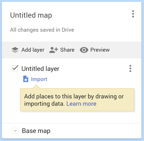
Click Import, select Google Drive and locate the log file
GPS Logger names the logs by date and time
Geo-located Photos : GPS enabled camera
Using a camera with built in GPS (such as a phone) is the simplest way to go. Take the photos as usual then use Google Photos.
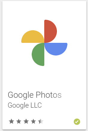
Easiest way to get the photos into your MyMap is to use the Google Photo app. Add the photos you want to overlay onto the route to an album.
Then create a new layer in your MyMap and click import.
The Import function has the option to import from ‘Photo Albums’. Select the album you just created. The photos are imported and automatically placed over the route based on GPS location.
Geo-located Photos : *Any* camera
BEFORE starting your adventure set the camera time to closely match the phone you are using for logging the route.
Using GPicSync software found here https://sourceforge.net/projects/gpicsync/
GPicSync uses the timestamp in each photo and the time & GPS location stored in the GPS log. It then writes the GPS location into the EXIF data in each of the photos. Once this is done add the photos to a Google Photos album and import as before.